 Click To Enlarge
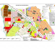
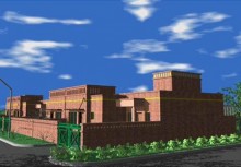
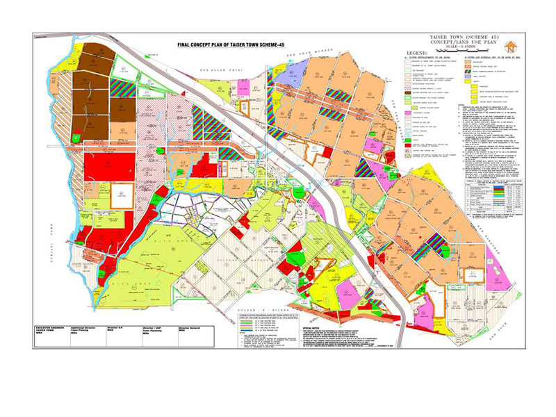
Master Planning of 20,570 Acres for Taiser Town Scheme-45
BACK TO PROJECTS
Name of associated firm :
-
Project Location within Country:
Karachi
Start Date:
August 2003
Completion Date:
In Progress
Project Description
The project was awarded by Malir Development Project of City District Government Karachi, (MDP) for town / master planning and development of infrastructure for Taiser Town (Scheme 45). To achieve the objective following tasks were undertaken; Topographic survey of the entire project area depicting all existing natural and man-made feature on the ground, a land use survey, a socioeconomic survey of the existing settlements and environmental study. This information formed the basis for the preparation of a Master Plan/Concept/Land use Plan.
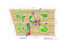
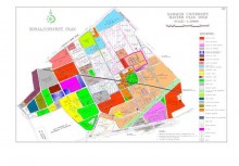
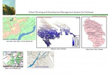
The detailed planning exercise included zoning, concept plan, and consolidation of private land, detailed working drawings of residential, commercial and amenity sectors. Infrastructure Planning, design, and Construction Supervision covered roads, water supply, sewerage, drainage network and design of treatment plants with cost estimates and preparation of PC-I tender documents and Construction Supervision. ECIL adopted an integrated approach of projecting infrastructure layers on GIS platform. High Resolution Imagery was utilized for developing baseline datasets for delineating Land Use Patterns and other infrastructure layers. GIS based Spatial Data Modelling was performed to project Topographic contours to establish terrain based water supply, drainage and other facilities design and implementation. A comprehensive GIS based Suit was developed utilizing technology based Town Planning approach.
Start Date (Month/Year): Completion Date (Month/Year):
Detailed Planning Phase-I:
August 2003 December 2005
Design / Construction Supervision Phase-I:
January 2006 July 2008
Detailed Planning Phase-II:
January 2006 December 2007
Design / Construction Supervision Phase-II:
January 2008 In Progress
Services
-
Data collection and investigation, including top-survey, Geo-tech investigations, socioeconomic survey and environmental study etc.
-
Land use planning, master planning, demarcation of plots
-
Acquisition of High Resolution Satellite Imagery
-
Image Processing and Classification
-
Topographic Data Grid Generation in Terrain Modelling
-
GIS based Concept Planning of Plots, Parcels and Infrastructure Layers
-
Integrated System Design of Infrastructure Layers on GIS platform
-
Design of amenities and infrastructure services
-
Detailed Design of major and minor roads, main and internal water supply and sewerage system, design of drainage systems, planning, design and Construction Supervision of treatment plants, oxidation plant etc.
-
Preparation of PC-I and tender documents and detailed supervision services shall also be provided
-
Detailed Construction Supervision & Project Management


